




El Niño can raise global temperatures and disrupt weather across several continents, yet the term is often misunderstood. The climate pattern starts in the tropical Pacific Ocean, but its effects can reach farms, cities, fisheries, and energy systems worldwide.
Often described as a “hot weather” event, El Niño does not guarantee extreme heat everywhere. Instead, it shifts ocean temperatures, winds, and rainfall patterns. Those changes can increase the odds of drought in some regions and flooding in others.
How El Niño Develops
El Niño is the warm phase of the El Niño-Southern Oscillation, known as ENSO. The cycle also includes a cooler phase called La Niña and a neutral phase.
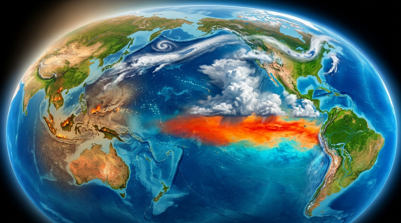
During El Niño, surface waters in the central and eastern tropical Pacific become warmer than usual. Trade winds, which normally push warm water westward, often weaken. Warm water then spreads east toward the Americas.
The warmer ocean releases heat into the atmosphere. This can move major areas of tropical rainfall and alter high-altitude winds. Those changes influence storm tracks far from the Pacific.
Scientists generally monitor several signs:
- Sea surface temperatures across key parts of the tropical Pacific
- Changes in trade winds and atmospheric pressure
- Cloud formation and rainfall near the equator
- Whether ocean warming lasts for several months
El Niño events usually emerge every two to seven years. They often strengthen late in the calendar year, though their timing and intensity vary.
Why It Can Make the Planet Hotter
The tropical Pacific stores a vast amount of heat. During El Niño, more of that heat reaches the atmosphere. As a result, El Niño years often rank among the warmest on record.



Human-caused climate change is separate from ENSO. Greenhouse gases produce a long-term rise in global temperatures, while El Niño causes shorter natural swings. When the two occur together, global heat records may face added pressure.
That does not mean every place will experience record warmth. Local conditions still depend on geography, season, ocean currents, and regional weather systems.
Weather Effects Differ by Region
El Niño often brings wetter conditions to parts of the southern United States and western South America. It can also increase drought risk in Australia, Indonesia, southern Africa, and parts of South Asia.
These are broad tendencies, not promises. A weak event may produce limited effects. A strong event can still depart from past patterns because no two episodes are identical.
Atlantic hurricane activity often falls during El Niño because stronger upper-level winds can disrupt developing storms. In the central and eastern Pacific, hurricane activity may increase under favorable conditions.
Marine ecosystems can also suffer. Warmer water near South America may reduce the supply of cold, nutrient-rich water from below. That can affect plankton, fish populations, seabirds, and commercial fishing.
What El Niño Means for Communities
The main risks often come from changes in rainfall rather than temperature alone. Heavy rain can trigger floods and landslides. Drought can cut harvests, strain water supplies, and raise wildfire danger.
Food prices may rise when poor growing conditions damage major crops. Governments and aid groups may also face greater demand for emergency support in areas exposed to drought or flooding.
Forecasts can help communities prepare, but they cannot predict exact local weather months ahead. Seasonal outlooks describe probabilities. Daily forecasts become more useful as an event approaches.
El Niño is therefore best understood as a global climate pattern that shifts weather risks, not a single heat wave or storm. Its full impact depends on its strength, duration, location, and interaction with long-term warming.
Future monitoring will focus on Pacific temperatures, winds, and rainfall. For households and officials, the practical step is to follow regional forecasts and prepare for the hazards most common locally.