


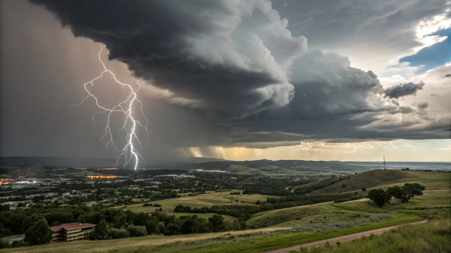
Two developing storm systems are marching toward the nation’s midsection, setting up days of heavy rain and severe weather that could hit millions across the South. Forecasters warn the setup could spin up tornadoes, trigger damaging winds, and unleash flash floods as the systems push into the Midwest.
“A pair of cross-country storms are developing and are pushing from the corners into the Midwest, allowing for rounds of heavy rain and a barrage of severe weather, threatening millions across the South with potential tornadoes, damaging winds and flash flooding.”
The storms are tapping deep moisture from the Gulf while pulling colder air from the north. That clash often fuels spring-like outbreaks even in winter months. The timing, track, and speed will decide who sees the worst impacts, but the warning from forecasters is clear: this pattern can turn fast.
Why This Setup Is Dangerous
Meteorologists watch for three ingredients: warm, humid air at the surface; strong winds changing speed and direction with height; and a lifting trigger like a cold front. This week’s pair of storms checks each box. That raises the chance for rotating thunderstorms capable of tornadoes.
Heavy rain is also a major concern. Training storms can dump inches of water over the same spots. Even a short burst can flood low-lying roads and small streams. Urban areas with poor drainage face the highest risk of quick water rises.
Wind damage may extend far from any tornado. Straight-line gusts from severe storms can topple trees and power lines. Those hazards often cover larger areas than tornado tracks and can last through the night.
Who Is Most At Risk
The threat stretches from the Gulf Coast to the lower Ohio Valley as the storms sweep north and east. Communities along the Mississippi River basin could be in the bull’s-eye for both severe thunderstorms and flooding.
- Southern states: risk for tornadoes, large hail, and flash flooding.
- Lower Midwest: damaging winds and flooding as storms merge.
- Urban centers: rapid runoff and roadway flooding.
Travelers should expect delays along major interstates if storms line up over key routes. Air travel may see ripple effects as storms trigger ground stops in multiple hubs.
Lessons From Recent Seasons
Late-winter and early-spring outbreaks are not rare. In recent years, warm Gulf air and strong jet stream winds have produced several overnight events. Those tend to be more dangerous because people are asleep when warnings hit. Forecasters have pushed for earlier alerts and clearer messaging to help families act faster.


Emergency managers say the same steps save lives every time. Know your safe place, keep multiple ways to receive alerts, and do not drive through flooded roads. Even six inches of fast-moving water can knock a person off their feet. A foot or more can sweep a car away.
What Forecasters Are Watching
Small changes in storm track can shift the severe zone by dozens of miles. Analysts will watch:
- How much Gulf moisture surges inland.
- Where the strongest wind shear overlaps with storms.
- Whether storms form discreet cells or a long line.
Discrete supercells are more prone to tornadoes. Long squall lines focus more on damaging winds and quick-hitting floods. Either mode can knock out power and block roads for hours.
What To Do Now
Residents across the South and Midwest should review plans today. Charge phones and weather radios. Clear gutters and storm drains if it is safe to do so. Move outdoor furniture and trash bins that can turn into debris.
Schools and businesses should confirm shelter procedures. Night-shift workers in plants and warehouses need clear steps for where to go if a tornado warning hits. Pet owners should plan for safe sheltering, including carriers and leashes ready to go.
Outlook And Next Steps
This double-barreled pattern can produce several rounds of storms as each system passes. The first wave may prime soils for flooding in the next. Rivers could swell after repeated downpours, even if each day’s rain seems modest on its own.
As warnings are issued, local officials will likely open shelters and close flooded roads. Power crews may be positioned ahead of time to speed recovery. Airlines and rail operators could adjust schedules to avoid the worst of the weather.
The bottom line: the ingredients are in place for a messy week. People in the path should stay weather-aware, act on warnings quickly, and avoid flooded areas. Forecasters will refine the details as new data arrives. Watch for upgrades to risk levels, and prepare for shifting impacts as the two storms move into the heart of the country.