




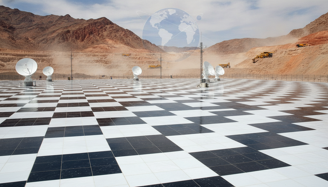
A rare site used to fine-tune NASA satellites may sit on top of a major deposit of a heavy metal used in munitions, setting up a collision between science and resource extraction. The site’s unusual surface helps keep Earth-observing data accurate. Interest in the metal, which supports defense manufacturing, has raised new questions about how to balance national needs with long-term research.
A unique landform is vital for calibrating NASA’s satellites, but it’s likely sitting atop a vast deposit of the heavy metal, which is crucial for making munitions
The timing matters. Satellite data are central to tracking climate, water, and crops. Global demand for strategic metals is also climbing. The result is a high-stakes choice over how land is used, who benefits, and what risks are acceptable.
Why This Landform Matters to Space Science
NASA relies on stable, uniform targets on Earth to check and adjust satellite sensors. These are often bright, flat surfaces that do not change much over time. Engineers use them to measure sensor drift, compare instruments, and align multi-year records.
Such places help verify data from imaging systems, infrared sensors, and radar. Small errors, if not caught, can warp records of temperature, vegetation, and ice. That can mislead scientists and policy makers who depend on satellite trends.
These sites are rare because they must be wide, dry, and consistent across seasons. Even minor surface changes, like tire tracks or evaporation ponds, can introduce noise into sensor readings.
Rising Demand for a Strategic Metal
The heavy metal under the site is described as important for munitions. Defense supply chains prize such metals for hardness, density, or heat resistance. They are used in projectiles, armor, and components that must perform under stress.
Prices and exploration activity tend to surge when supply is tight or imports look uncertain. Governments treat these deposits as strategic reserves. That status can speed up leasing and permits, and it can complicate efforts to set land aside for research.
Clashing Priorities on Public Lands
Conflicts over land use have grown as more sectors rely on the same open spaces. Space agencies value surface stability and access. Miners need to drill, move soil, and build infrastructure. Local communities weigh jobs against noise, dust, and traffic.



Scientists warn that even limited disturbance near calibration targets can reduce data quality. Once disturbed, surface conditions may not return to their prior state for years. That can disrupt long-term climate and land imaging records.
- Calibration sites require large, uniform areas with minimal change.
- Mining can fragment surfaces and alter reflectance and moisture.
- Lost calibration sites are hard to replace and validate.
Potential Paths to Compromise
Policy makers face a narrow path. One option is to create protective buffers around the most sensitive zones, while allowing exploration farther out. Agencies could share maps of critical sight lines used by satellite overpasses, then guide activity away from those corridors.
Another step is to phase work to avoid key observation windows. Many satellites follow predictable paths and times. Scheduling heavy work outside those windows could reduce interference, though it may not solve long-term surface change.
Independent monitoring would help. If mining proceeds, frequent checks of surface uniformity could alert agencies to drift in calibration values. That would let engineers adjust algorithms or shift to backup sites if needed.
What Is at Stake for Data Users
Farmers, water managers, and city planners rely on satellite products for daily decisions. Calibration drift can ripple through drought maps, wildfire risk models, and crop yield forecasts. Errors can be small at first, but they accumulate across years.
Defense users also rely on accurate Earth observation. Weather, ocean conditions, and terrain data support missions and logistics. Thus both mining and satellite accuracy tie back to national security, but in different ways.
Looking Ahead
The next moves will likely hinge on surveys that define the deposit and on studies that measure how much disturbance the site can tolerate. Clear criteria for what counts as an acceptable change will be critical. Without that, disputes can drag on while damage occurs.
Public comment, tribal consultation, and scientific review will shape the outcome. Transparent timelines and data sharing can reduce uncertainty for all sides. If officials protect the core calibration zone and direct industrial activity to less sensitive areas, both goals may be partially met.
The choice will signal how the country ranks knowledge infrastructure against near-term resource needs. If the site is safeguarded, global satellite records will remain stable. If mining advances without strong safeguards, agencies may face costly work to rebuild calibration elsewhere and to fix data gaps that affect science and daily life.