





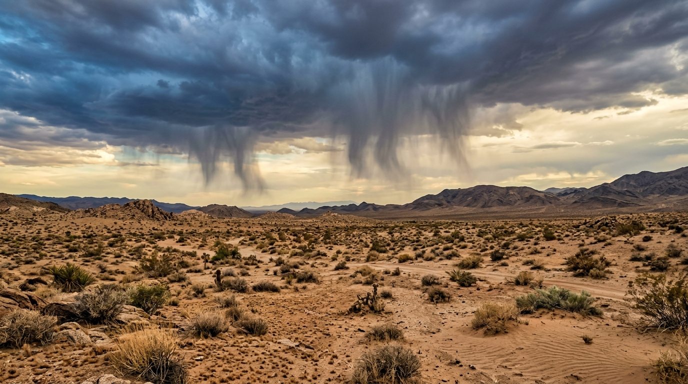
Rain sometimes falls from clouds over deserts but disappears before reaching the ground, leaving dry soil beneath visible streaks of precipitation.
The weather event is called virga. It occurs when rain or snow enters a layer of warm, dry air and evaporates. The process helps explain why threatening clouds may produce little or no measurable rainfall in arid regions.
How Rain Disappears in Midair
Rain begins when water droplets or ice crystals inside a cloud grow heavy enough to fall. Whether they reach the surface depends on the air below.
Desert air often has very low humidity. Falling drops enter that dry layer, where liquid water changes into water vapor. Smaller drops may disappear quickly, while larger ones can travel farther before evaporating.
“Some rain in the desert falls but evaporates before landing.”
From a distance, virga may look like gray curtains hanging beneath a cloud. The streaks often narrow or fade before reaching the horizon. This visual pattern separates virga from rain shafts that make contact with the ground.
Why Dry Air Changes a Storm
Humidity is only one factor. Air temperature, wind, drop size and the depth of the dry layer also affect how much rain survives.
Evaporation cools the surrounding air. That cooler air becomes denser and may sink rapidly. In some storms, the sinking air spreads outward near the surface and produces sharp wind gusts.
Those winds can create hazards even when no rain reaches an observer. Blowing dust may reduce visibility on roads. Sudden crosswinds can also affect drivers and aircraft.


- Low humidity speeds evaporation.
- Small droplets vanish sooner than large drops.
- Deep dry layers give rain more time to disappear.
- Evaporative cooling can strengthen sinking air.
Visible Rain Does Not Guarantee Relief
Virga matters in deserts because communities, farms and ecosystems may depend on limited rainfall. A cloud can appear promising while adding no water to the soil, reservoirs or plants below.
Weather instruments can also detect precipitation above the surface even when ground gauges remain dry. Radar sends energy into the atmosphere and measures what returns from droplets or ice. As a result, a radar image may show rain where residents report none.
Forecasters compare radar information with humidity readings, surface observations and weather balloons. These measurements help determine whether precipitation is likely to survive its fall.
A Common Feature of Arid Weather
The phenomenon is especially easy to notice in dry climates, but it is not limited to deserts. Virga can occur wherever precipitation falls through air dry enough to absorb it.
Its presence offers a clear lesson about rainfall: water leaving a cloud is not the same as water reaching the ground. The atmosphere between those two points can change the outcome.
For people under desert clouds, fading rain streaks may signal continued dryness or an approaching gust of wind. Watching surface reports alongside radar remains the best way to tell whether a storm is delivering water or losing it to the air.